Illustrated Maps
C'est La Classe!

Client

Loescher Editore — Torino
(founded 1861)

Scope

Illustrated Map Design · Information Design · Educational Publishing · Editorial Illustration

Year

2017–2019

Illustrated Maps — C'est La Classe!
01 — Brief

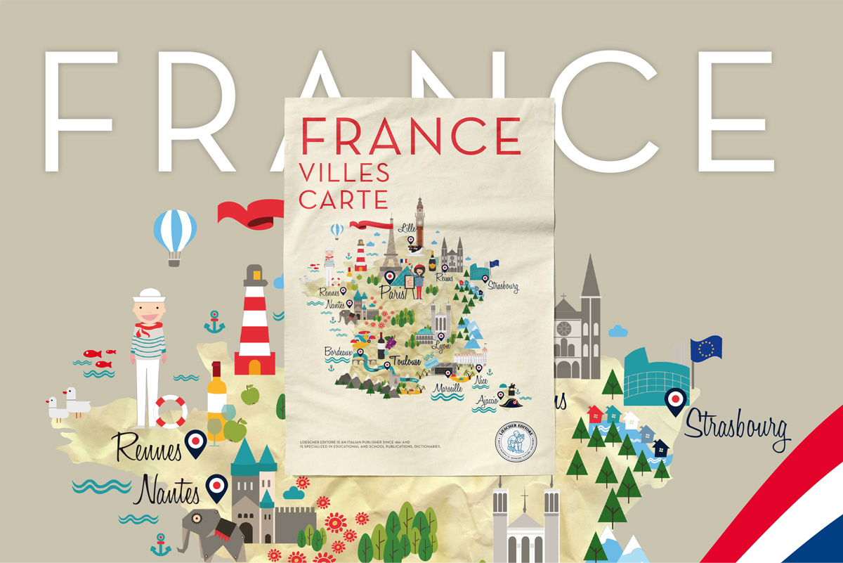
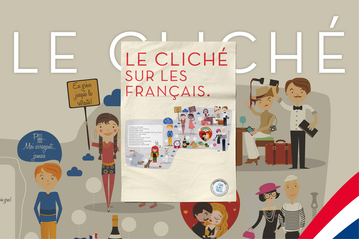
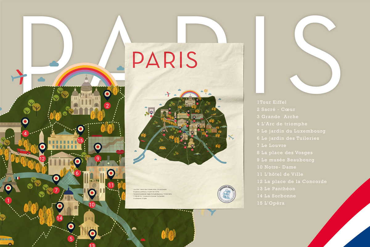
Geography as a Learning Tool

Loescher Editore, an Italian educational publisher founded in 1861 and specialised in language learning and school publications, commissioned a series of illustrated maps for their French language course book C'est La Classe! Each map needed to work simultaneously as an educational tool and as a visually engaging illustration — functional information design that could hold the attention of secondary school students.

The challenge was to translate complex geographic and cultural data — festival locations, city information, francophone distribution worldwide — into clear, charming visual systems that matched the playful, colourful tone of the language course while remaining informationally precise.

02 — The System

Flat Illustration Meets Information Architecture

Each map was built in Adobe Illustrator using a consistent flat illustration language: a warm parchment background evoking classic cartography, custom-drawn architectural and cultural icons for each location, a red and navy colour palette referencing the French tricolore, and a clear typographic hierarchy distinguishing place names from descriptive labels.

The icon system was designed to be immediately readable at textbook scale — each city or location identifiable through a single representative illustration rather than generic pins. Paris has the Eiffel Tower and the Seine; Strasbourg its cathedral; Lyon its gastronomy. The maps read as illustrations first, data second.

03 — The Maps

Paris · France · Festivals · Le Cliché

The series includes five maps covering different scales and subjects: the Top 15 Places to Visit in Paris, the France Cities Map, the Festival Map of France, the Francophone Countries Map, and Le Cliché sur les Français — a playful infographic exploring French cultural stereotypes as a language learning exercise.

Paris — Top 15 Places to Visit illustrated map France Cities Map — illustrated map detail Carte de France des Festivals — festival map Le Cliché sur les Français — cultural infographic
← Iconic Posters The Archangels →